UN
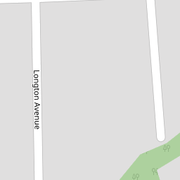
23 Longton Avenue
£ 37,000
Description
We don't have a Description for this property.
- Bedrooms
- 2
- Bathrooms
- 0

Leaflet © OpenStreetMap contributors
The heatmap indicates the level of crime in the area. The color of the heatmap indicates the crime severity and recency.
Metrics Year-on-Year
- Average area value
- 188,142.00 £Increased by 2.93 %
- Average area rental value
- 524.00 £/moDecreased by 29.38 %
- Est rental Yield
- 3.34 %Decreased by 31.42 %
- Crime Rate
- 5.00 %Unchanged by 0.00 %
from 182,786.00 £
from 742.00 £/mo
from 4.87 %
from 5.00 %
Nearby Schools
| Name | Type | Ofsted | Distance |
|---|---|---|---|
| Sacred Heart Catholic Primary School, Thornton Cleveleys | Voluntary Aided School | Good | 0.36 KM |
| Great Arley School | Community Special School | Good | 0.38 KM |
| Thornton-Cleveleys Red Marsh School | Community Special School | Outstanding | 0.47 KM |
| Thornton Primary School | Community School | Good | 0.62 KM |
| Thornton Cleveleys Royles Brook Primary School | Community School | Good | 0.97 KM |
Images
Nearby Streets
| Name | Average Price | Average Sqft | Distance |
|---|---|---|---|
| Ferndale Close | £ 185,000 | 0 | 0.00 KM |
| Patten Place | £ 165,000 | 0 | 0.00 KM |
| Millfield Court | £ 0 | 0 | 0.00 KM |
| Mill Close | £ 174,975 | 0 | 0.00 KM |
| Butts Road | £ 347,475 | 0 | 0.00 KM |
Nearby Transport
| Name | NLC | TLC | Distance |
|---|---|---|---|
| Poulton-Le-Fylde | 2671 | PFY | 3.86 KM |
| Layton (Lancs) | 2669 | LAY | 5.29 KM |
| Blackpool North | 2739 | BPN | 7.66 KM |
| Blackpool South | 2740 | BPS | 9.86 KM |
Nearby Listings
| Address | Price | Type | Score | Distance |
|---|---|---|---|---|
| Longton Avenue, Thornton-Cleveleys, FY5 | £ 130,000 | BUY | 6 / 10 | 0.00 KM |
| Woodland Avenue, Thornton, FY5 | £ 164,000 | BUY | Unknown | 0.11 KM |
| Trunnah Road, Thornton-Cleveleys, Lancashire, FY5 4HF | £ 90,000 | BUY | 6 / 10 | 0.12 KM |
| Sandyforth Avenue, Thornton, FY5 | £ 130,000 | BUY | 5 / 10 | 0.15 KM |
| Sandyforth Avenue, Thornton, FY5 | £ 200,000 | BUY | Unknown | 0.15 KM |
Nearby Properties
| Address | Price | Distance |
|---|---|---|
| 20 Longton Avenue | £ 96,000 | 0.00 KM |
| 11 Longton Avenue | £ 82,500 | 0.00 KM |
| 23 Longton Avenue | £ 37,000 | 0.00 KM |
| 13 Longton Avenue | £ 104,000 | 0.00 KM |
| 10 Longton Avenue | £ 98,500 | 0.00 KM |